
Pinnacle Falls


Pinnacle Falls is a trek and a half to get to. Seriously, driving out here is half the journey. The trek will take you through mining and logging property, and though not recommended, you can make it the whole way in a sedan, so long as a big storm hasn’t washed out the road. The road is marked by white signs with black writing that says ‘FALLS’ with an arrow pointing you in the right direction. Depending on the car you’re driving (or your ability to take a low-clearance car down rugged roads), there are a few places you can stop to head for the trailhead.
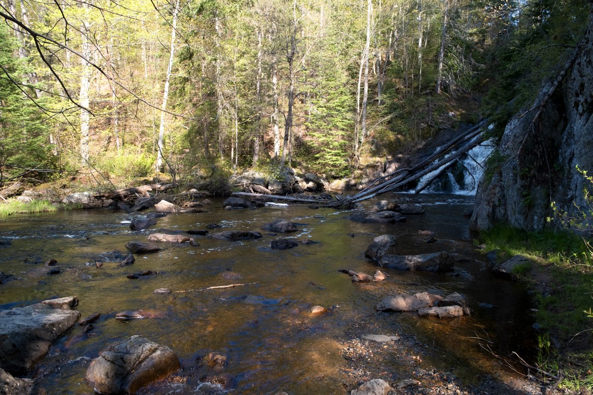
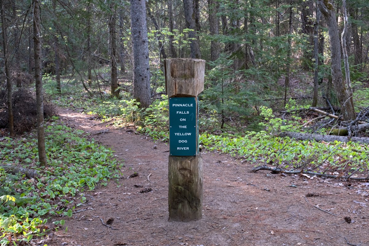
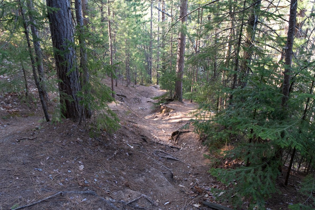
Once you reach the official trailhead, either by car, foot, or ATV, the trail is reasonably easy to follow. Depending on what time of year you visit the falls, it may be better or worse for wear. On our first visit, there were a lot of downed trees and confusing portions, but this was early in the season, likely before Yellow Dog River Watershed volunteers could host cleanup efforts. Still, my dog Scrappy and I were able to navigate our way to the falls. The trail is a steep downward journey on the way there, so be prepared to wrestle that on the way there and tackle it on the way back.
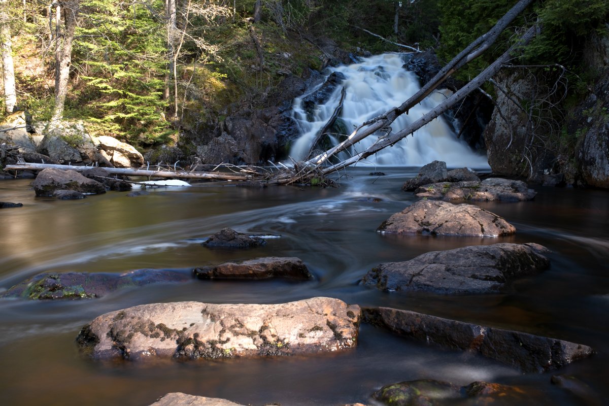
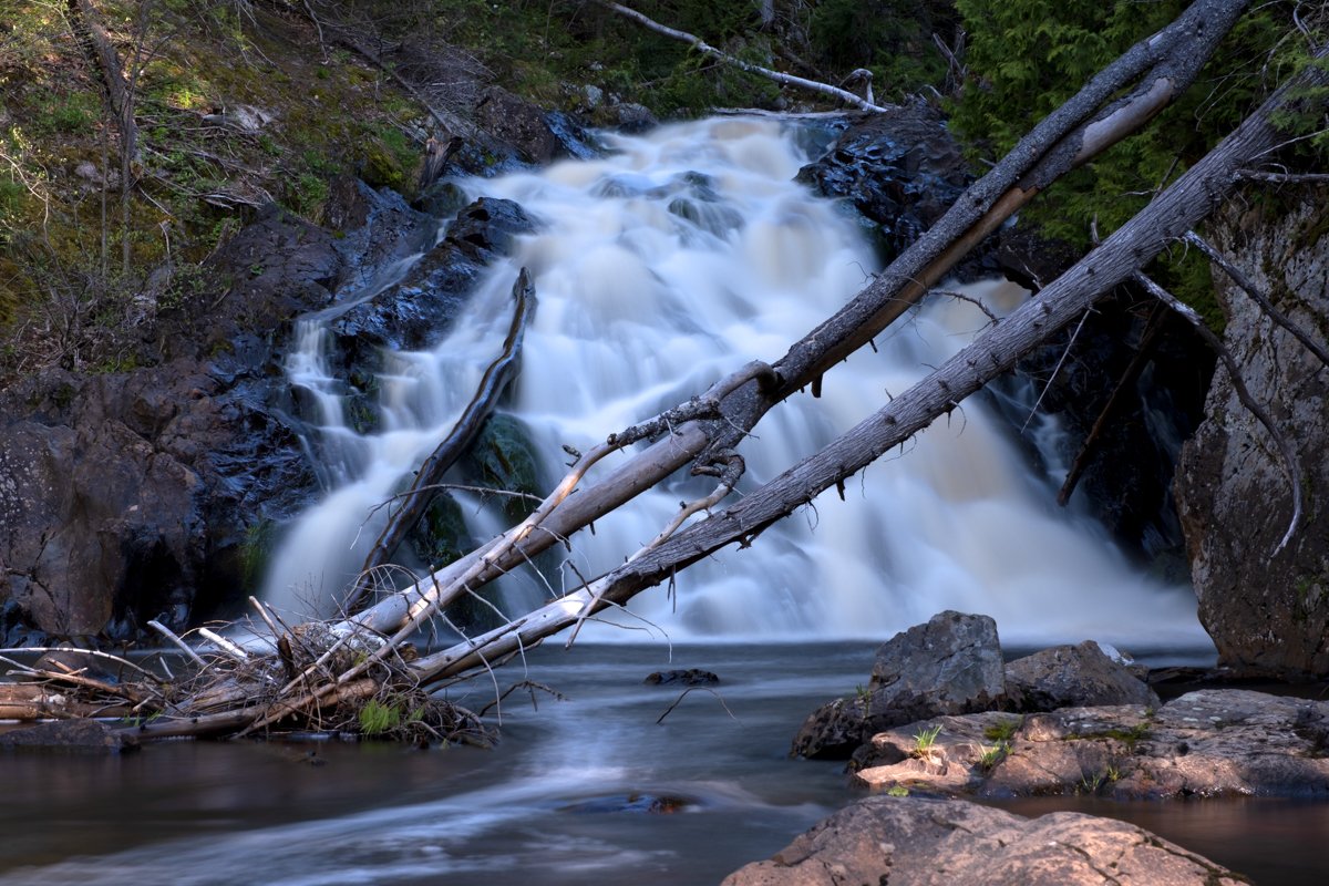
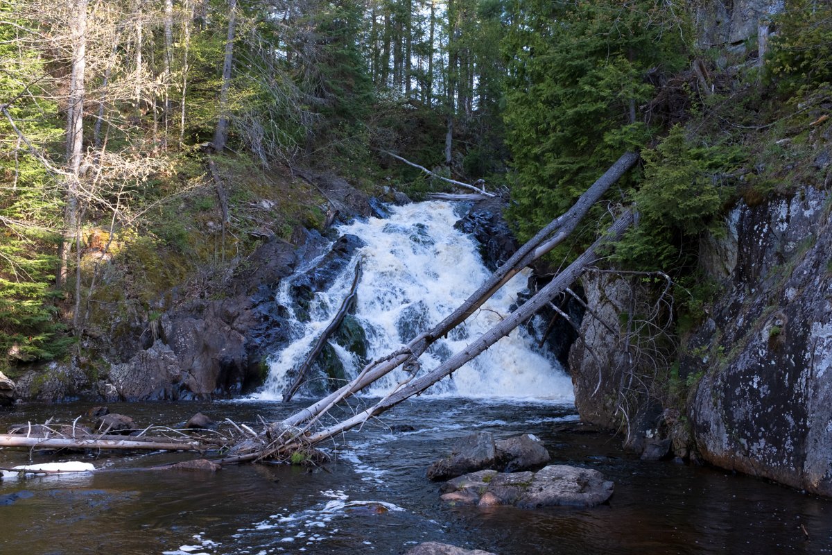
The view from the trail’s end is well worth the hike, but getting a proper view of Pinnacle Falls without getting your feet wet can be challenging. There are plenty of rocks in the river to stand on, which is helpful, and if you go in the summer, the water level will likely be lower, so you can stand further into the riverbed without getting too wet. In recent years, a tree fell close to the falls, which is somewhat in the way of the view. Don’t get me wrong; it’s still breathtaking; however, it would be handy if that were removed in the coming years for those who make the trek out to get a better view of the falls.
There was a dam at the top of the falls in the late 1800s; however, it’s been gone for over a century. Today, it’s incredibly remote and popular for hiking, fishing for trout, and birding.
The way back is more challenging because you’re going uphill, but you know where to go, as you’ve already traversed the trail. Using a tracking app like Strava is handy so you can follow your path back if you get confused. Or, download Google Maps for the area before going, as you won’t have service here.
Though the drive is hectic for non-4-wheel-drive cars, and the hike is steep, the view of Pinnacle Falls is well worth the journey. The Yellow Dog River is one of the pristine waterways of the Marquette area, and the work that the Yellow Dog Watershed Preserve does is worth commending. They also manage the area around Yellow Dog River Falls, which is further downstream towards Lake Superior!
From the trailhead (which I drove to in a sedan), the hike out and back to Pinnacle Falls was 1.18 miles with 277 feet of elevation gain.